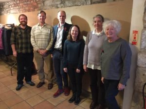
What a super day that was, a dazzling array of speakers who informed and entertained the audience with a box of delights from around the North West.
First from the post was Rick Peterson who outlined developments in the Whitewell area. Fairy Holes cave with its intriguing well developed opening has a long history of occupation albeit intermittently and an early Bronze Age (EBA) cremation has been found. Onto Mosley Heights near Cliviger Gorge inbetween Burnley and Todmorden where the Walter Bennett (of literary fame) mounted a voluntary rescue operation before the site was developed for open cast mining by the NCB. In just four weeks with the help of untrained sixth form volunteers he rescued a good number of artefacts from the EBA cairn site, including blades, arrowheads and barbed and tongued arrows, scraper, knife a ground stone and pot boilers. Bennett found the pottery leaving the cupboard bare when Rick and Uclan students later dug and reappraised the site. They did discover though that the collared urn made from local clay had white bits within the wall of the pot which is thought to be ground up human bone. Thus demonstrating the commemorative aspect of cultural life in the BA. Both of these sites demonstrate long term usage, the EBA being the last phase of habitation and both are local to us. Rick has a blog site – Sheltering Memory – it is well worth a visit.

Prehistory Study Day. Speakers from left, Mike Woods, Kevin Grice, Rick Peterson, Sam Walsh, Catherine Rousseau- Jones and Chair Gayle Wray. Attribution: A Hardman
Next off the block was Kevin Grice a Community Archaeologist involved with uncovering Warton Crag which according to the Victoria County History is “situated in a perfect position on a prominent limestone hill” overlooking Morecambe Bay with a wonderful 360 degree panorama. It is a site on the ‘At risk’ register it is also a triple SI which means that the archaeology comes after the natural habitat and preservation of fauna and flora. Research via maps, antiquarian and modern sources and Lidar revealed a triumvallete hill fort. In 1912 Jackson found the bones of 20 humans and it was deemed a sepulcharal site. The Warton Sword now in the British Museum is an iron sword with a bronze pommel but may not be from the site. It may be that the site wasn’t inhabited permanently but was a defensive look out or a meeting or ceremonial place. Kevin showed images of intriguing upper ramparts, the site is well worth a visit, however be warned conditions underfoot are treacherous, the ramparts can be seen from the butterfly rides. He also demonstrated that Hutchinson’s map of 1785 was remarkable in that it closely aligns with todays Lidar images of the site. Our attention was drawn to other intriguing sites around Morecambe Bay for example Castle Head and Skelmore Head where BA connections have been confirmed. There must have been links to Stanwick a huge Iron Age fort, thought to be the headquarters of Cartimandua, four miles away. An intriguing site and due for reappraisal according to Kevin.

Warton Crag IA Hillfort.
Attribution: Kevin Grice
Debbie Hallam revealed the palimpsest landscape of the Yorkshire Dales making us folk from Lancashire fair envious of the huge numbers of artefacts that the earth has revealed over the past decades. Clusters of finds around Skipton and Romabald moor number around 45,900 lithics. John Thorpe’s collection numbers around eighteen thousand and there are other smaller collections. The material was surprisingly mostly flint, followed by chert (in one area flint was 92.4% and chert 7.6%) and the assemblages were mostly flake, blade and microliths. From Malham Tarn area came an early Neolithic leaf blade. All finds were well above sea level and away from the valley floors. Regarding the various types of ceramics there was a link here to the collared urn with the white bits mentioned earlier on Mosley Heights where at Talthorpe sherds were decorated with bird bone. In 2018 Backstone Beck in Ilkley gave up Groove ware and lithics and across the beck rock art was available for discovery. Watlowes at Malham also delivered beaker pottery and jet was found in Arncliffe and Darnbrook, the nearest place where jet was found is Ireland! How amazing is this and almost on our doorstep.
Did you know?
There is a 1576 map of Lancashire commissioned by William Cecil the most important minister in Elizabeth 1’s reign, whilst it shows Warton Crag it also shows other hills suitable for beacons to warn of the Spanish Armada demonstrating that the Invasion was not just an English Channel problem. (Kevin Grice)
That Tom Booth maintains that the genetic ancestry of some dales folk is from Anatolian Aegean neolithic farmers (modern Turkey) it is thought that these continental migrants brought different farming and cultural practices to our Mesolithic ancestors. Apparently this is still a live debate. (Debbie Hallam)
Banner Image: Shaft hole adze. Attribution: Debbie Hallam